
| [Home -> Armin Grewe's holidays -> Scotland Summer 2004 -> Goatfell] [Contact] |
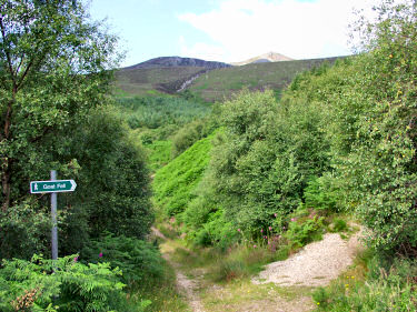 |
Soon after breakfast I left for my first walk on the Isle of Arran: The highest summit on Arran, Goatfell, was my destination. First I walked along the coast through Corrie until I reached the path to Goatfell. The way first follows a road, which then turns into a car track. After a while a sign points out the start of the footpath along Corrie Burn. For a while the path goes through woodland before gaining some height.
After leaving the woodlands the view opens up for a very nice view over the Firth of Clyde (panorama below). The view stretches from the Isle of Bute in the north over Great Cumbrae and Little Cumbrae and the Ayrshire coast. If you have a fast connection (or some time) you can also view a QuickTime VR panorama of the view over the Firth of Clyde (Note: 1.3MB download). I think it's worth it. |
 |
|
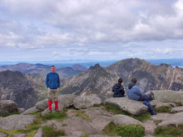 |
It took me about two hours until I reached the summit of Goatfell (874m/2866ft). Unfortunately clouds had started to move in, in particular to the east I couldn't see much. The views south, west and north were still magnificient though. Using the trig point as an emergency tripod I took a few pictures of me with the mountains of Arran (and around) as background. Just behind me you can make out the Paps of Jura on the horizon. Between me and the other walkers is Cir Mhor, behind them Caisteal Abhail.
I took pictures for several panoramas, the one below came out best. If you have a fast connection (or enough time) you can also view a QuickTime VR panorama of the view west from Goatfell (1.8MB download). The panorama stretches all the way from Brodick Bay in the south to Glen Sannox in the north. It doesn't really do the view justice, but I think it's the best you can get apart from actually being there. |
 |
|
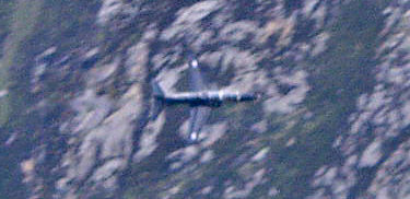 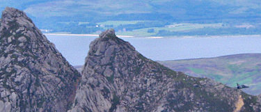 |
While I was on the summit of Goatfell we had some "entertainment": A plane (I guess it was some kind of RAF training jet) flew very low through Glen Rosa, then "jumped" over The Saddle and flew just past the Witch's Step. Unfortunately my zoom wasn't strong enough, so I can only offer the grainy pictures on the left. First the plane with the steep slopes of Glen Rosa behind it, second the Witch's Step with the plane passing to the right.
From Goatfell I continued north, first to North Goatfell and then Mullach Buidhe. From just below the summit of Goatfell I had the nice view north, you can also see a QuickTime VR panorama of North Goatfell, Mullach Buidhe and Coire Lan (1.8 MB download). As it had cleared up towards the east now I had good visibility over Coire Lan and the Firth of Clyde. The footpath coming up from Corrie is very visible, Corrie Burn flowing next to it. Corrie itself isn't visible though, only a few houses of High Corrie can be made out through the trees. |
 |
|
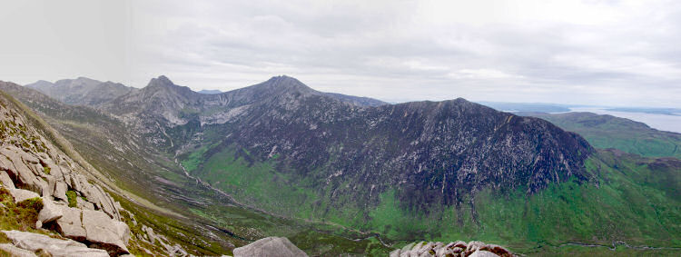
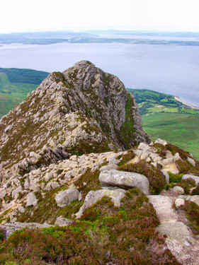 While there weren't as many other walkers as on Goatfell I still wasn't alone: From Mullach Buidhe I spotted these walkers on the slopes of North Goatfell looking over Glen Rosa and over to Kintyre. As it was slowly getting darker and looked like rain was moving in from the west I continued on my way back to Corrie. While there weren't as many other walkers as on Goatfell I still wasn't alone: From Mullach Buidhe I spotted these walkers on the slopes of North Goatfell looking over Glen Rosa and over to Kintyre. As it was slowly getting darker and looked like rain was moving in from the west I continued on my way back to Corrie.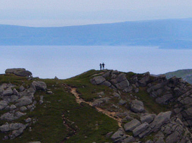 I followed the path towards Cioch na h-Oighe, occasionally having to scramble over a few rocky crests. Visibility was getting poorer and poorer, only allowing for a fairly dull view back into Glen Sannox. Still impressive though. Then the only part left was the descent to South Sannox. Unfortunately the iris of my camera got stuck at this point, so I was unable to take any pictures any more. When I arrived at the foot of Cioch na h-Oighe rain set it, I had made it down just in time to avoid having to scramble over wet and potentially slippy rocks. Somehow I also enjoyed walking the rest of the way back to Corrie through the rain, the rain was relaxing and cooling after quite a lot of sun and the exercise during the day. All in all a great day out with some fantastic views. I followed the path towards Cioch na h-Oighe, occasionally having to scramble over a few rocky crests. Visibility was getting poorer and poorer, only allowing for a fairly dull view back into Glen Sannox. Still impressive though. Then the only part left was the descent to South Sannox. Unfortunately the iris of my camera got stuck at this point, so I was unable to take any pictures any more. When I arrived at the foot of Cioch na h-Oighe rain set it, I had made it down just in time to avoid having to scramble over wet and potentially slippy rocks. Somehow I also enjoyed walking the rest of the way back to Corrie through the rain, the rain was relaxing and cooling after quite a lot of sun and the exercise during the day. All in all a great day out with some fantastic views. |
|
This walk is also described in Walking on the Isle of Arran (A Cicerone Guide) by Paddy Dillon as Walk 38, Corrie & Goatfell (although I walked it the other way around than described in the book). The map I used for this walk is the Explorer Map 0361: Isle of Arran (Explorer Maps). |
|
Previous: Travelling to Arran <- Scotland Summer 2004 -> Next: Around Arran
 |
Copyright © 2004-2006 Armin Grewe - FAQ |
 |